Precipitation
Precipitation occurs when atmospheric moisture becomes too great to remain suspended in clouds. It denotes all forms of water that reach the earth from the atmosphere, the usual forms being rainfall, snowfall, hail, frost and dew. Once it reaches the earth’s surface, precipitation can become surface water runoff, surface water storage, glacial ice, water for plants, groundwater, or may evaporate and return immediately to the atmosphere. Ocean evaporation is the greatest source (about 90%) of precipitation.
Rainfall is the predominant form of precipitation and its distribution over the world and within a country. The former is shown in Figure 4, which is taken from the site http://cics.umd.edu/~yin/GPCP/main.html of the Global Precipitation Climatology Project (GPCP) is an element of the Global Energy and Water Cycle Experiment (GEWEX) of the World Climate Research program (WCRP).
Figure 4. A typical distribution of global precipitation (Courtesy: Global Precipitation Climatology Project)
The distribution of precipitation for our country as recorded by the India Meteorological Department (IMD) is presented in the web-site of IMD http://www.imd.ernet.in/section/climate/. One typical distribution is shown in Figure 5 and it may be observed that rainfall is substantially non-uniform, both in space and over time.
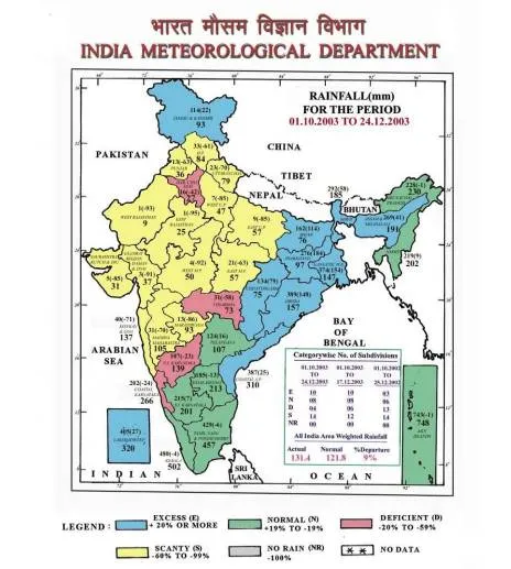
Figure 5. A typical distribution of rainfall within India for a particular week (Courtsey: India Meteorological Department)
India has a typical monsoon climate. At this time, the surface winds undergo a complete reversal from January to July, and cause two types of monsoon. In winter dry and cold air from land in the northern latitudes flows southwest (northeast monsoon), while in summer warm and humid air originates over the ocean and flows in the opposite direction (southwest monsoon), accounting for some 70 to 95 percent of the annual rainfall. The average annual rainfall is estimated as 1170 mm over the country, but varies significantly from place to place. In the northwest desert of Rajasthan, the average annual rainfall is lower than 150 mm/year. In the broad belt extending from Madhya Pradesh up to Tamil Nadu, through Maharastra, parts of Andhra Pradesh and Karnataka, the average annual rainfall is generally lower than 500 mm/year. At the other extreme, more than 10000 mm of rainfall occurs in some portion of the Khasi Hills in the northeast of the country in a short period of four months. In other parts of the northeast (Assam, Arunachal Pradesh, Mizoram, etc.,) west coast and in sub-Himalayan West Bengal the average annual rainfall is about 2500 mm.
Except in the northwest of India, inter annual variability of rainfall in relatively low. The main areas affected by severe droughts are Rajasthan, Gujarat (Kutch and Saurashtra).
The year can be divided into four seasons:
• The winter or northeast monsoon season from January to February.
• The hot season from March to May.
• The summer or south west monsoon from June to September.
• The post – monsoon season from October to December.
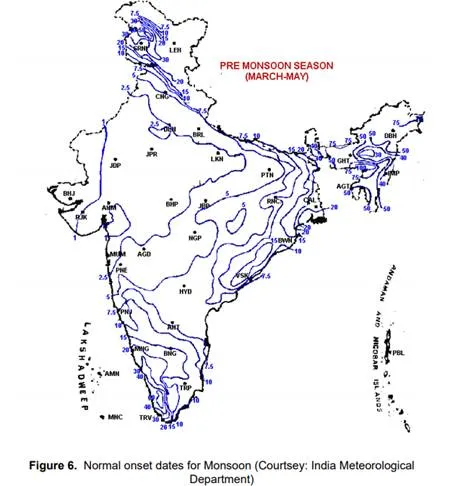
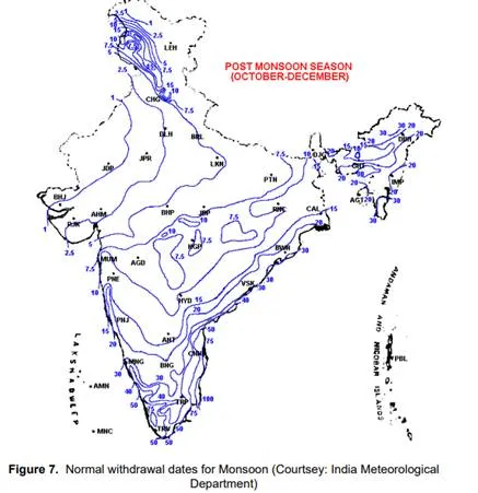
The monsoon winds advance over the country either from the Arabian Sea or from the Bay of Bengal. In India, the south-west monsoon is the principal rainy season, which contributes over 75% of the annual rainfall received over a major portion of the country. The normal dates of onset (Figure 6) and withdrawal (Figure 7) of monsoon rains provide a rough estimate of the duration of monsoon rains at any region.