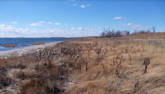

Located in Queens, New York on the northern shore of Jamaica Bay, Spring Creek South contains approximately 237 acres of undeveloped land, including wetlands and 2.4 miles of coastline. The site is bounded by the Howard Beach residential neighborhood in Queens, a commercial area along Cross Bay Boulevard, the Belt Parkway, and Jamaica Bay. The northwest section of Spring Creek South is part of the National Park Service’s Gateway National Recreation Area, and is largely comprised of small patches of degraded tidal marsh and disturbed and degraded upland ecosystems.
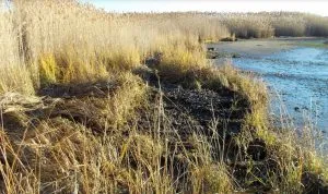
On October 29, 2012, Hurricane Sandy drove a catastrophic storm surge into the New Jersey and New York coastlines. Spring Creek South and the surrounding community of Howard Beach experienced record flooding and damage to property and critical infrastructure. Storm tides caused damage and erosion along the shoreline and in the salt marsh area, degrading important habitat and leaving the site vulnerable to invasive species.
The New York State Division of Homeland Security and Emergency Services (NYSDHSES) was awarded funding from FEMA’s Hazard Mitigation Grant Program to restore Spring Creek South. The U.S. Army Corps of Engineers (USACE) New York District, serving as project administrator, contracted Princeton Hydro to provide ecosystem restoration services. The goal of the project is to reduce future flood risk exposure while also protecting, restoring, and improving the quality and function of ecological systems; improving stormwater management and water quality; and enhancing the park’s visitor experience.
To achieve this goal, the project team is using an integrated approach that involves utilizing green infrastructure to create a natural barrier for the community and reduce the risks of coastal storms. Project activities include berm construction and the restoration of tidal marsh, creation of freshwater wetland forest, and creation of maritime shrub, forest, and grassland habitats, as well as stabilization of the existing shoreline.
 On December 31, 2018, we completed Phase One of the project, which entails engineering design and preliminary permitting. More specifically, we’ve provided conceptual planning; analysis of subsurface soils for geotechnical properties and hazardous waste; coastal and freshwater wetland delineations; biological benchmarking analysis; and the development of sea level rise curves and two-dimensional hydrologic and hydraulic coastal modeling. As part of the hydrology study, we analyzed what the site could be expected to look like in 50 years due to climate changes and sea level rise. Our engineering design was also brought to 65% completion.
We also obtained permits, prepared the Environmental Assessment (EA), and oversaw the National Environmental Policy Act (NEPA) process. The EA received a “Finding of No Significant Impact” (FONSI) from FEMA, which means the environmental analysis and interagency review concluded that the project has no significant impacts on the quality of the environment.
Due to the complex nature of this project and its location, we are coordinating with a variety of different entities, including the local Howard Beach Community Board, the FAA (proximity to JFK International Airport), Port Authority, USACE, NOAA Fisheries, USFWS, USEPA, NYSDEC, NYC DEP, the National Park Service, HDR Engineering and WSP Engineering.
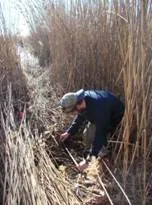
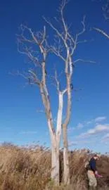
 Phase Two of the project is the construction phase, which is expected to take about two years to complete. A key part of the Spring Creek South construction activities is the restoration of approximately 40 acres of tidal marsh, which is anticipated to improve water quality locally by stabilizing sediment, reducing erosion, and filtering dissolved particulate materials. The project team will restore existing coastline areas and install a salt marsh along the shoreline. Planted with native flora, like Spartina alterniflora, a perennial deciduous grass found in intertidal wetlands, the coastal salt marsh will help to stabilize sediment. Additionally, removing invasive species like Phragmites australis from the area and replacing it with native plant species will increase the ability for native vegetation to colonize the site, improve vegetative diversity, and reduce fire risk in the park.
 A forested wetland area and berm will also be created in order to provide the surrounding communities with natural shields and buffers to future storms. The berm, with an elevation of 19 feet (NAVD88), will help to manage the risk of storm surge flooding caused by coastal storms. The forested wetland area will also provide improved stormwater runoff storage, naturally filter stormwater, and, via flap gates, direct its flow toward Jamaica Bay, away from residential and commercial properties.
These measures will help to dissipate wind and wave energy, increase shoreline resilience, improve stormwater management at the site, and create habitat that increases the ecological value and biodiversity at the site, while providing resilience benefits. Restoration activities will benefit vulnerable and rare ecological communities by producing localized environmental enhancements, including improving water quality and creating and restoring habitat. The project also increases opportunities for recreational uses such as wildlife viewing/photography, fishing, and nature study.