
Way up in Northern New York, the St. Lawrence River splits the state’s North Country region and Canada, historically acting as an incredibly important resource for navigation, trade, and recreation. Along the St. Lawrence River is the St. Lawrence Seaway, a system of locks, canals, and channels in both Canada and the U.S. that allows oceangoing vessels to travel from the Atlantic Ocean all the way to the Great Lakes.
 Recently, the St. Lawrence Seaway Development Corporation (SLSDC) contracted Princeton Hydro to conduct analytical and geotechnical sampling on material they plan to dredge out of the Wiley-Dondero Canal. Before dredging, sediment and soils have to be tested to ensure their content is suitable for beneficial reuse of dredged material. In August, our Geologist, Marshall Thomas and Environmental Scientist, Pat Rose, took a trip up north to conduct soil sampling and testing at two different sites within the canal near Massena and the Eisenhower Lock, which were designated by the SLSDC. The first site was at the SLSDC Marine Base, which is a tug/mooring area directly southwest of Snell Lock. The second location was directly northeast of the Eisenhower Lock, which is also used as a mooring area. Both of these sites require dredging in order to maintain mooring access for boat traffic navigating the channel.
During this two-day sampling event, our team, which also included two licensed drillers from Atlantic Testing Laboratories, used a variety of equipment to extract the necessary samples from the riverbed. Some of the sampling equipment included:
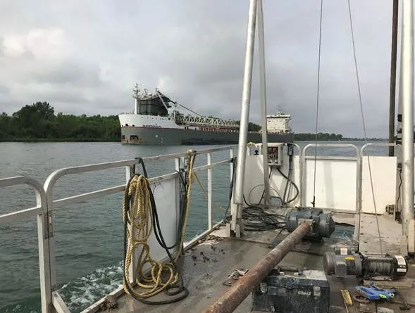
· Vibracoring equipment: this sampling apparatus was assembled on Atlantic Testing’s pontoon boat. To set up the vibracore, a long metal casing tube was mounted on the boat more than 10 feet in the air. The steel casing was lowered through the water approximately 17-20 feet down to the mudline. From there, the vibracore was then vibrated through the sediment for an additional 4-6 feet. For this project, vibracore samples were taken at 4 feet in 10 different locations, and at 6 feet in 3 different locations.
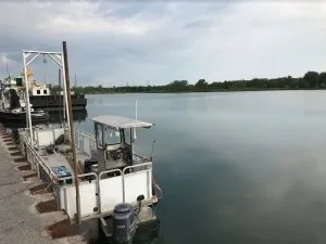
· A track mounted drill rig: this rig was positioned along the shoreline to allow advancement of a standard geotechnical test boring close to existing sheet piling. Advancement of the boring was done by way of a 6-inch hollow stem auger. As the auger was advanced, it resembled a giant screw getting twisted into the ground. This drilling method allows the drilling crew to collect soil samples using a split spoon sampler, which is a 2-foot long tubular sample collection device that is split down the middle. The samplers were collected by driving the split spoon into the soil using a 140 lb drop hammer.
Vibracoring Equipment
Track mounted drill rig
For our team, conducting sampling work on the St. Lawrence Seaway was a new experience, given most of our projects occur further east in the Mid-Atlantic region. The most notable difference was the hardness of the sediment. Because the St. Lawrence River sediments contain poorly sorted, dense glacial till, augering into it took a little more elbow grease than typical sediments further south do. The St. Lawrence River is situated within a geological depression that was once occupied by glaciers. As the glaciers retreated, they were eventually replaced by the Champlain Sea, which flooded the area between 13,000 and 9,500 years ago. Later on, the continent underwent a slight uplift, ultimately creating a riverlike watercourse that we now deem the St. Lawrence River. Because it was once occupied by a glacier, this region is full of glacial deposits.
For this project, our team was tasked with collecting both geotechnical and analytical samples for physical and analytical testing. Physical testing included grain size analysis, moisture content, and Atterberg limit testing. Grain size analysis helps determine the distribution of particle sizes of the sample in order to classify the material, moisture content testing determines exactly that — how moist the sediment is, and Atterberg limits help to classify the fines content of the materials as either silt or clay. Analytical testing included heavy metals, pesticides, volatile organic compounds, and dioxins.
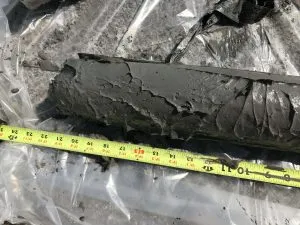
 Our scientists were responsible for logging, testing, and providing a thorough analysis of fourteen sampling locations. The samples collected from the vibracore tubes filled with sediment were logged and spilt on-shore. In order to maintain a high level of safety due to the possible presence of contaminants, all of the sampling equipment was decontaminated. This process involves washing everything with a soapy water mixture, a methanol solution, and 10% nitric acid solution.
The samples collected at each vibrocore location were split into multiple jars for both analytical and physical testing. The physical test samples were placed into air and moisture tight glass sample jars and brought to our AASHTO accredited soils laboratory in Sicklerville, New Jersey for testing. The analytical samples were placed into airtight glass sample jars with Teflon-lined caps. These samples were then placed into an ice-filled cooler and sent to Alpha Analytical Laboratories for the necessary analytical testing.
Once all the laboratory testing was completed, a summary report was developed and presented to the client. This report was made to inform the SLSDC of the physical properties of each sediment sample tested and whether contaminants exceeded threshold concentrations as outlined in the New York State Department of Environmental Conservation (NYSDEC) Technical & Operation Guidance Series (TOGS) 5.1.9. This data will ultimately be used by the SLSDC to determine the proper method for dredging of the material and how to properly dispose of the material.