Geospacial Information System
As used in SSCM, a geospacial information system, or GIS, is a computer-based system for storing, analyzing, and displaying spatially-referenced data. The coverage of a GIS is selected to encompass the entity of interest and can be as large as a country, state, or county. For SSCM, GIS is used as a tool to aid crop management decisions. The coverage of each GIS is that of a single farm field and such a GIS could be considered a Field Information System (FIS).
Data input to a FIS
Input to a FIS can include any available data relevant to crop management decisions. The data can come from a variety of sources. Data on soil nutrients, moisture, texture, etc., can come from soil samples manually extracted from the soil at regular intervals in the field and processed in a soils laboratory. Alternatively, when appropriate sensors are available, the sensors can be positioned on an implement-mounted blade that is pulled through the soil. Machine vision sensors to capture crop-relevant data can be carried on low-flying aircraft or on satellites in space. Crop yield data can be captured by harvesters equipped with yield monitors.
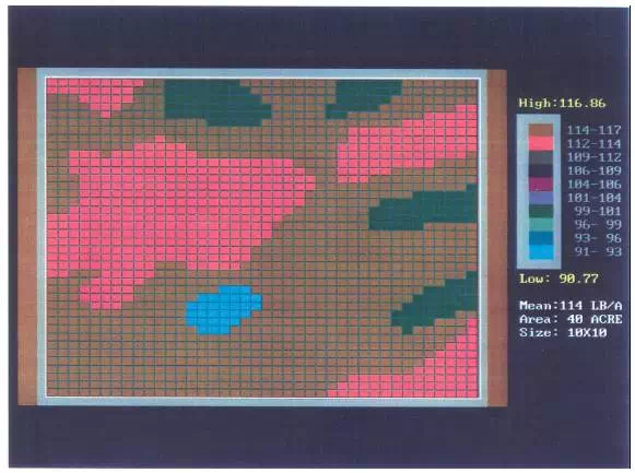
Typically, because the data vary spatially across a field, maps are used to represent the data in the FIS. For example, the map in Figure 6.2 shows spatially variable nitrogen application rates for a particular field. Other maps could show soil concentrations of potassium, phosphorous, or other factors relevant to crop production.